Nirapod – Community Safety & Real-Time Incident Alert Platform
Report. Alert. Protect. Building Safer Communities Through Real-Time Intelligence.
The Problem
Communities often lack a centralized and trusted platform for reporting local incidents, sharing safety information, and receiving timely alerts about nearby threats. Citizens frequently rely on social media groups, messaging apps, or word-of-mouth to learn about crimes, accidents, suspicious activities, fires, and emergencies. These methods are fragmented, unreliable, and often too slow to help people make informed safety decisions. Additionally, there is limited visibility into high-risk areas, making it difficult for residents, commuters, students, and families to stay aware of potential dangers in their surroundings.
Our Solution
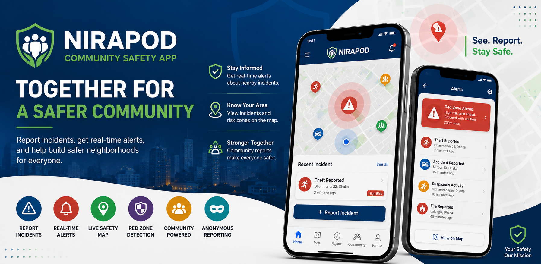
Nirapod is a community-powered safety platform that enables users to report incidents in real time, receive location-based alerts, and access a live safety map powered by community intelligence. The platform allows citizens to submit incident reports with images and location data, participate in community discussions, and receive notifications about nearby incidents and high-risk zones. Using geospatial analysis, Nirapod continuously evaluates reported incidents and identifies "Red Zones" where elevated safety risks exist. Users are automatically notified when approaching these areas, helping them make safer decisions about their routes and surroundings. Anonymous reporting and content moderation systems help encourage participation while maintaining platform integrity and accountability.
Outcome
Nirapod creates a real-time safety network that empowers communities to stay informed, report incidents quickly, and improve neighborhood awareness. The platform aims to: Increase community safety awareness Improve incident reporting efficiency Deliver faster local safety alerts Reduce information gaps during emergencies Help users avoid high-risk areas Build stronger community engagement around public safety Create a trusted database of local safety incidents
Key Features
- Real-Time Incident Reporting
- Submit incidents with images and location data
- Categorized reporting system
- Anonymous reporting option
- Nearby Safety Alerts
- Location-based incident notifications
- Customizable alert radius
- Real-time push notifications
- Red Zone Detection
- Community-driven risk analysis
- High-risk area identification
- Red zone proximity alerts
- Interactive Safety Map
- OpenStreetMap integration
- Live incident visualization
- Risk zone overlays
- Community Wall
- Community discussions
- Safety updates
- Comments and engagement features
- Anonymous Reporting
- Protect user identity
- Secure backend accountability
- Increased reporting confidence
- Content Moderation
- Automated moderation tools
- Community reporting system
- Administrative review dashboard
- User Trust System
- Report verification workflow
- Community trust scoring
- Verified incident indicators
- Admin Dashboard
- Incident moderation
- User management
- Safety analytics
- Risk zone monitoring
- Push Notification System
- Incident alerts
- Red zone notifications
- Community activity updates
Tech Stack
Build Something Similar?
Tell us about your project. We'll share how we'd approach it.
Start a Project